Western San Gabriel Mountains, CA

Stop #8:  San Andreas fault and freeway roadcut

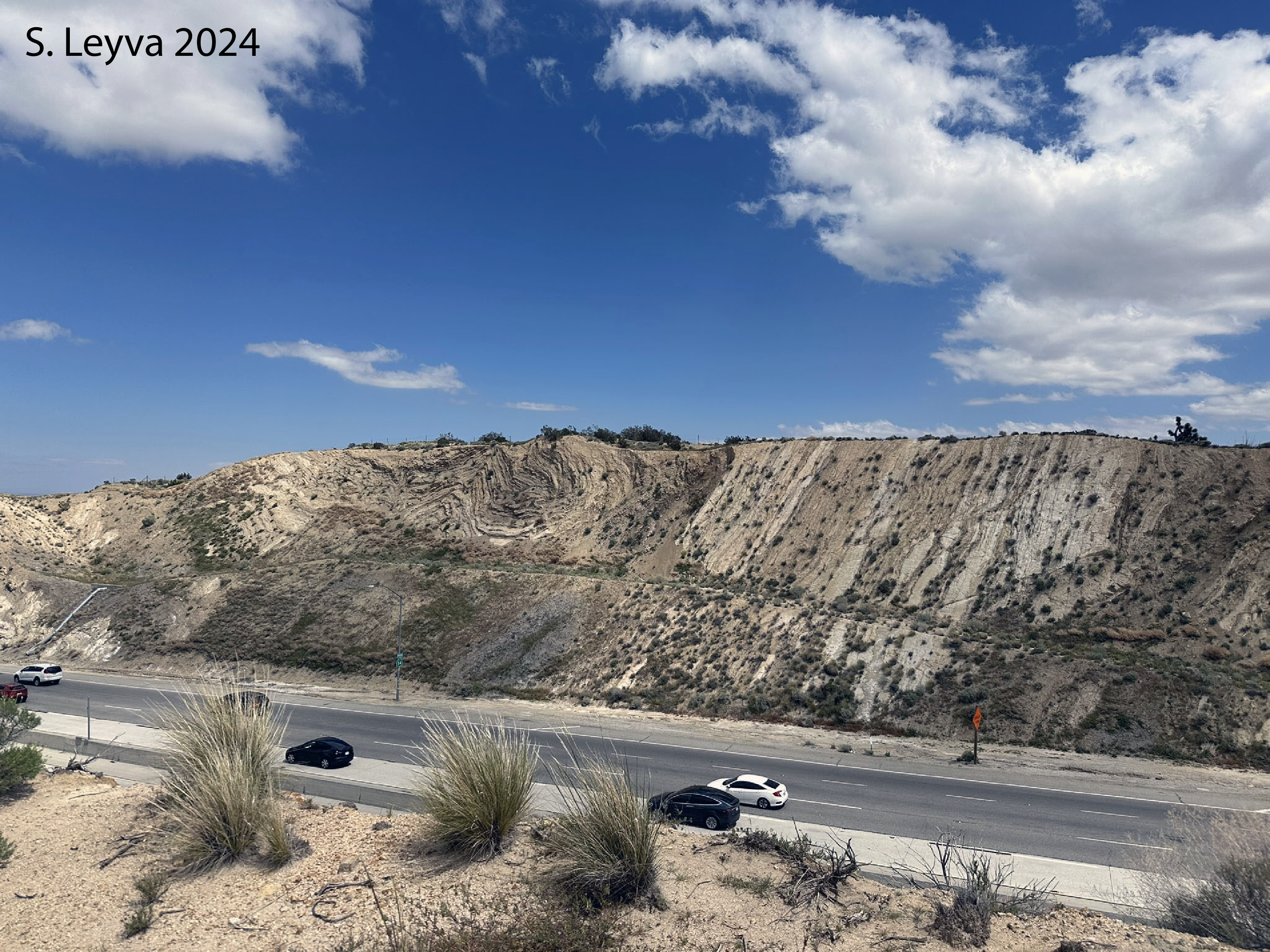
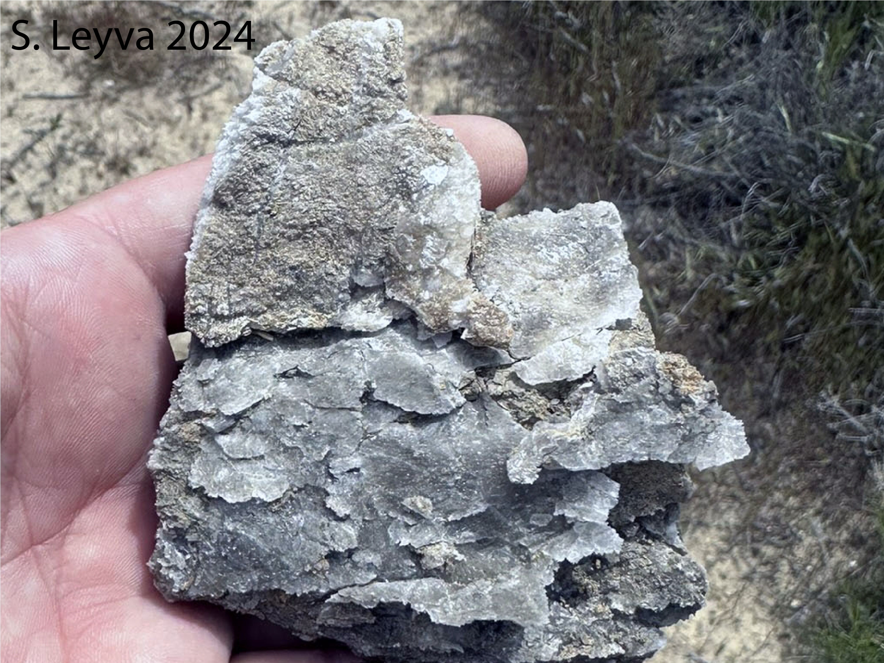
At this stop, we will rock across the San Andreas fault and view strongly folded sedimentary strata.
Although the fault does not look like a significant feature at this location, it is a profound structure
relative to plate tectonics. In walking approximately 20 feet we will be crossing from the Pacific plate
onto the North American plate. The San Andreas Fault Zone is a transform fault - most of which are located beneath the ocean and there are few places on land where you can walk across a boundary. Nearly all transform boundaries connect two segments of a spreading center. The San Andreas connects with the East Pacific Rise in the south and the Gorda Ridge in the north.

All transform plate boundaries are strike slip faults. The San Andreas is a right lateral strike slip fault, demonstrated by the fact that the North American plate on the east side of the fault appears to move to the right as the Pacific Plate creeps toward the northwest at about 5 cm per year (about 2.5 inches per year). The fault is presently “locked” by friction, so to accommodate the movement of the plates, the rock along the fault is slowly being stretched, somewhat like a rubber band. Eventually, the stress along the fault will overcome the friction and the fault will suddenly slip and create a large earthquake.

The last time the fault slipped along this portion of the fault was in 1857. The resulting earthquake is
known as the Ft. Tejon earthquake and is estimated to have been about magnitude 8.0. It is believed to
have been the largest magnitude earthquake in California historic time. Of the 5 cm/year that the Pacific
plate moves relative to the North American plate, about 3 cm/ yr is accommodated by the San Andreas
fault (other faults take up the rest of the slip). Given that the Ft. Tejon earthquake occurred 154 years
ago, the amount of slippage now being stored by bending of the rock adjacent to the fault is about 450 cmn(15 feet!). If the fault were to slip today, this is about how much slippage along the fault would likely
occur. A study of the fault in the 1970’s concluded that this section of the fault ruptures about once every
140 years. Based on this average recurrence interval we are already overdue for a large earthquake.

The rocks in the roadcut on the opposite side of the freeway ares part of the sedimentary Anaverde Formation, and include grey clayey shales with sandstone interbeds. Thick layers of gypsum are common. These beds have been spectacularly folded due to compressional forces associated with the motion of Pacific plate sliding past the North American plate along the San Andreas fault. 

The picture below shows the freeway roadcut. If you move your mouse over the image, you will see some of the layers noted (in white). "A" and "B" are a series of folds while highly tilted beds form on the right. What type of folds do "A" and "B" represent?

Image of a roadcut with a series of folds on the left and highly tilted bedding on the right.


Gypsum can be found on the surfaces of rocks fallen from the roadcut. Below are two photos of rocks with gypsum on it.