Cabrillo Beach Coastal Processes Trip
Sunken City
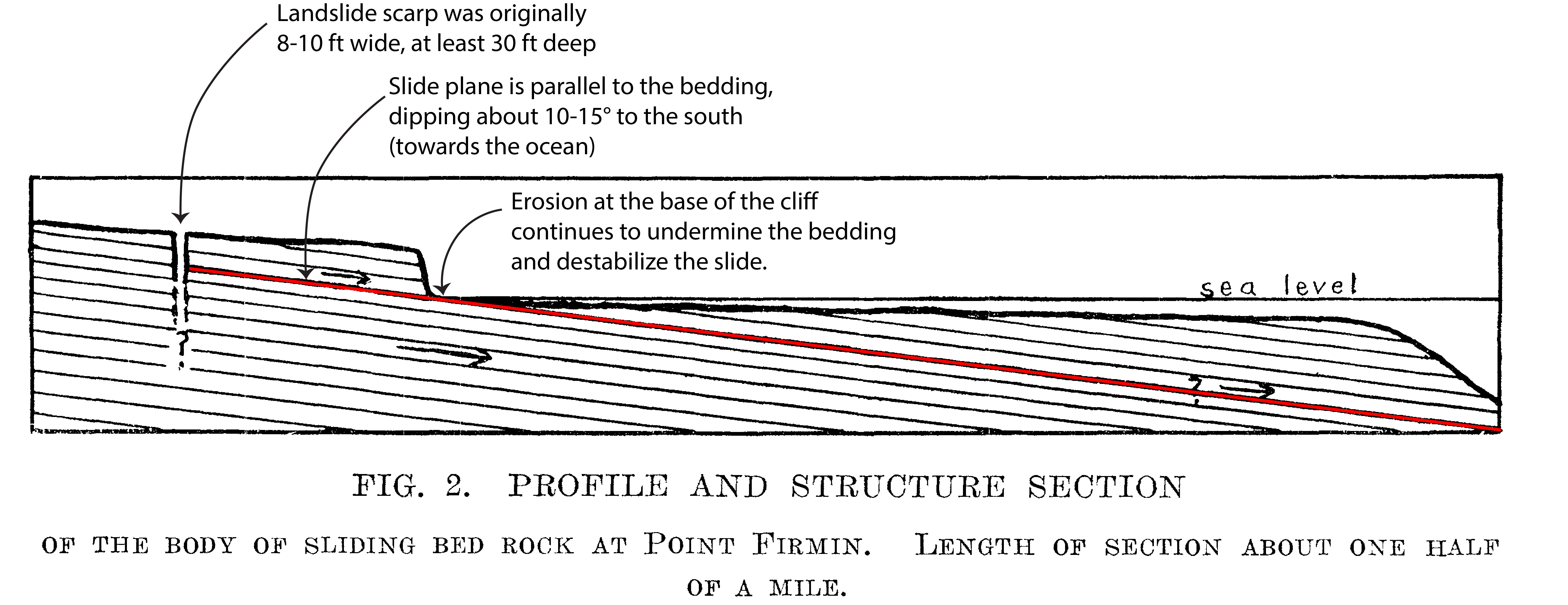
What happened? Three million years ago the Peninsula began to rise out of the Pacific Ocean. As it did, the land began to buckle and fold into a series of anticlines and syclines. The result is that the beds on the coastal side of the Peninsula are all dipping in the same direction as the slope (aka a dip slope) aproximately 10-15 degrees to the south. This is also called adverse bedding and is a leading cause of slope failure wherever the condition is found. It is especially problematic in coastal areas, where the crash of the waves on the cliffs undermines the area, making an already bad problem worse. Another problem is the bedrock itself. The Miocene aged Altamira Shale member of the Monterey Formation is comprised of thin layers of siliceous and phosphatic shale - which is very slick when wet. Most landslides in the Southern California region are within shales and siltstones found in Miocene aged formations. Initally, the landslide scarp was 8-10 ft wide and at least 30 ft deep. The lowering of the water table in the area and a small earthquake on July 8, 1929, increased the rate of movement, and, with time, has slowed. Erosion continues, however. A 2007 study by the USGS found that the cliffs in the Point Fermin area have retreated 64 ft in the past 70 years.
|
||||||||||||||||||||||||||||